Nasca, Peru
Terrain disturbance and threat assessment with airborne and satellite SAR data

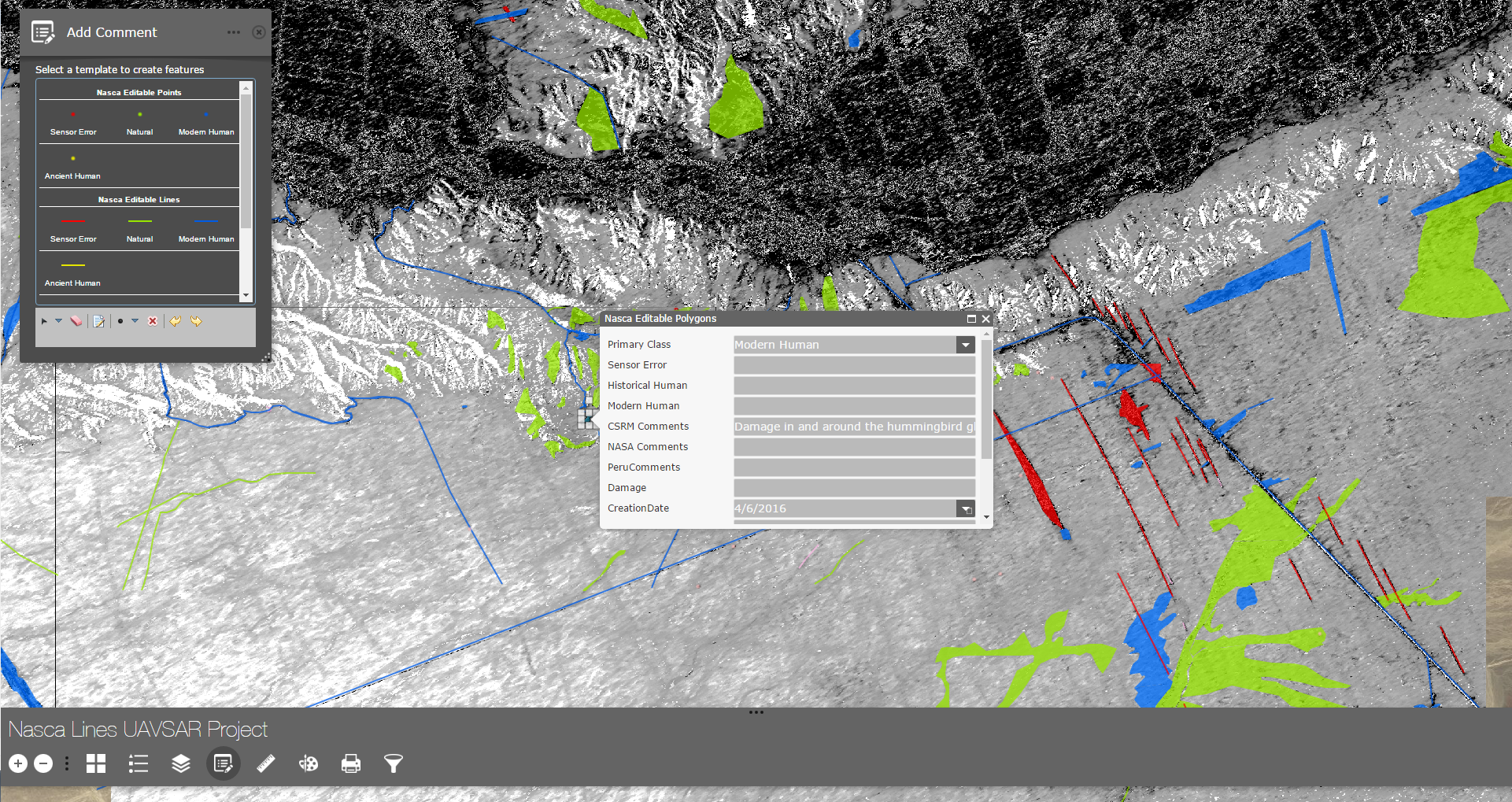


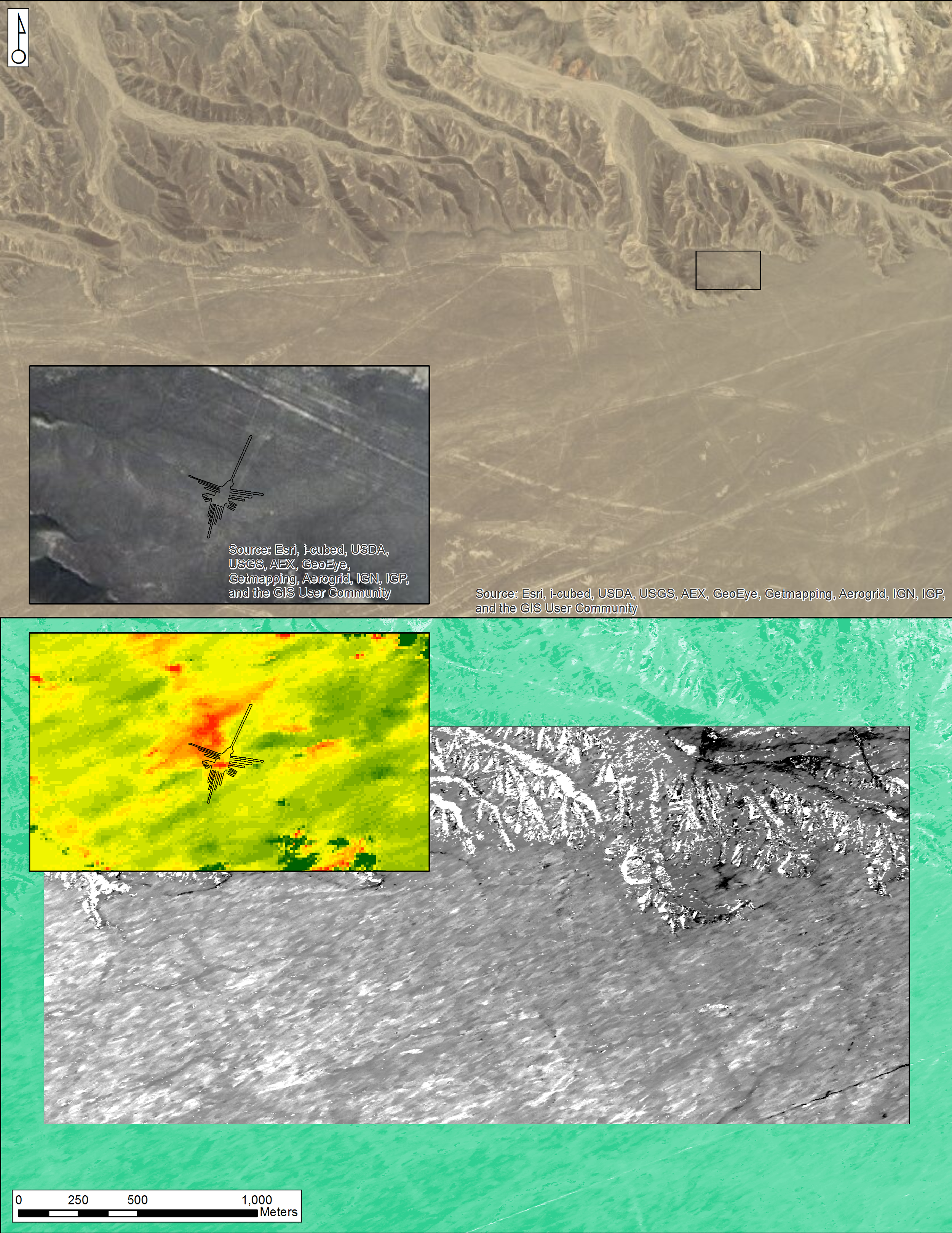


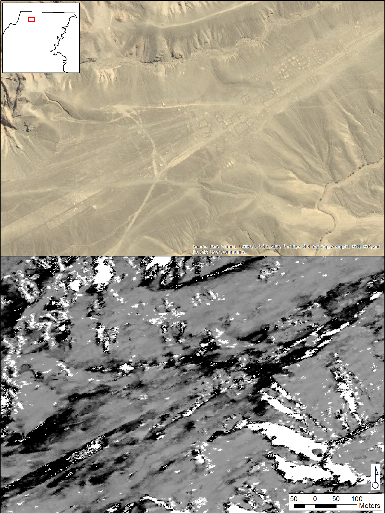


In collaboration with a synthetic aperture radar (SAR) expert from NASA’s Jet Propulsion Laboratory (JPL) and archaeologists, CSRM Foundation used SAR data to detect terrain disturbance and threats to the world-renowned archaeological features and natural environment at the Nasca and Pampas de Jumana World Heritage Site, in southern Peru. With SAR collected from both aircraft and satellites, we were able to map and measure changes to the ground surface in and near the site. Some of these changes were damaging, or potentially damaging, to the famous Nasca Lines.
SAR is often excellent for measuring and modeling the surface of the ground. By comparing SAR data acquisitions that were collected over the same area at different times, we were able to make maps that showed where the landscape had changed between the data acquisitions. These maps also provided a measure of how dramatic the landscape changes were, which allowed us to quantify threats to run statistical tests to assess them.
The maps make it easy to see which parts of the site are most threatened. In some cases, the maps suggest the causes of disturbance as well—for example, people walking or driving off the road, or the encroachment of land development—which is helpful to site managers. And our statistical tests helped us distinguish between natural changes to the landscape and disturbances caused by people.
Among the disturbances we found and tested was that caused by the temporary installation of a sign by Greenpeace, an environmental NGO, on the ground beside one of the most famous of the Nasca Lines, the Hummingbird. We published papers about this and our other activities and findings in the journals Conservation and Management of Archaeological Sites and Geosciences.